
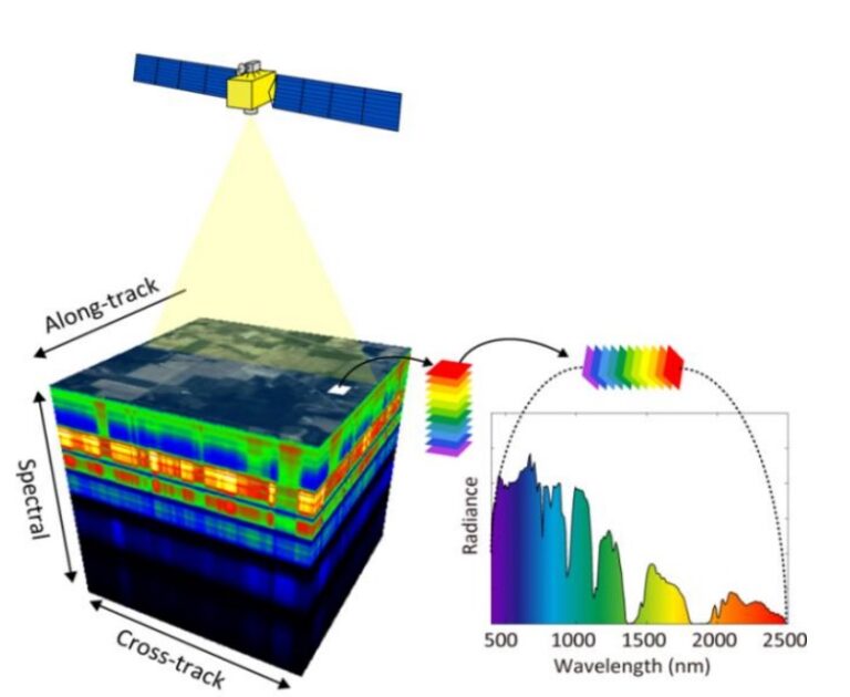
Introduction Hyperspectral imaging (HSI) has emerged as a transformative technology in the field of earth observation. By capturing information across hundreds of spectral bands, HSI allows us to...
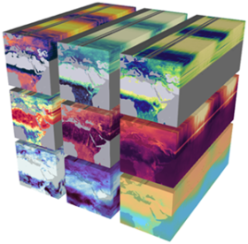
Introduction In the era of big data, managing and analyzing vast amounts of remote sensing data can be overwhelming. Enter data cubes—a revolutionary approach to organizing, processing, and analyzing...
Introduction Geospatial data has been at the heart of technological advances across industries, enabling applications ranging from smart cities to disaster management. As we move into 2025, the...

Introduction Quantum computing is heralded as the next big leap in computational technology. By leveraging the principles of quantum mechanics, quantum computers promise to solve problems that are...
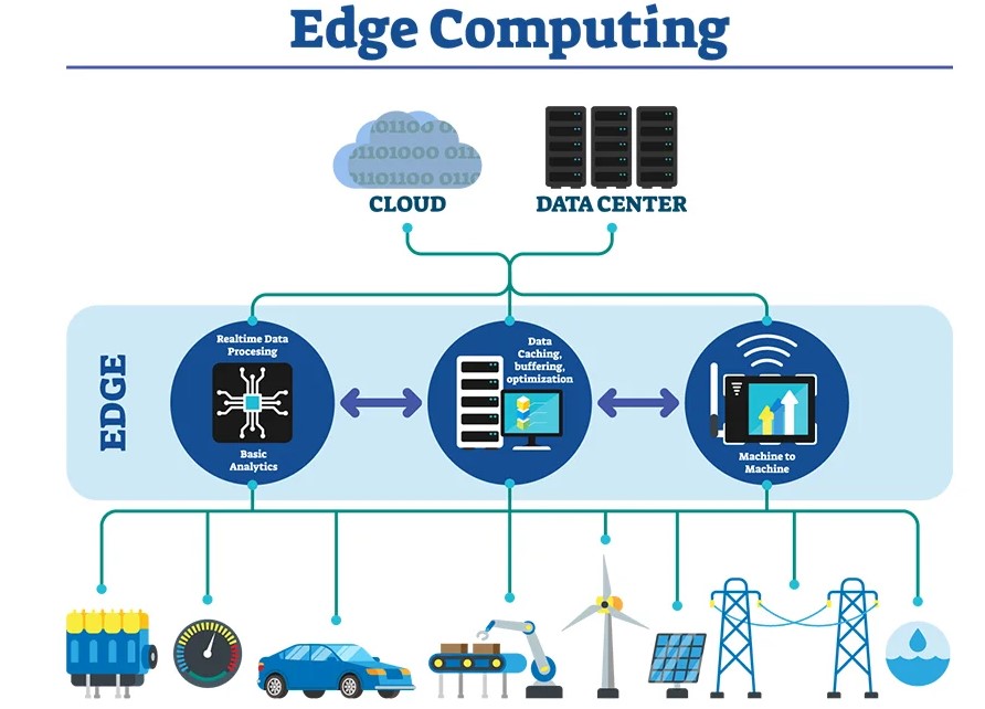
Introduction As geospatial data generation accelerates due to the proliferation of IoT devices, satellites, and sensors, the demand for real-time analytics has surged. Traditional centralized...

Introduction Artificial Intelligence (AI) is revolutionizing the geospatial industry, transforming how Earth observation data is collected, analyzed, and applied. Geospatial AI, or GeoAI, combines...